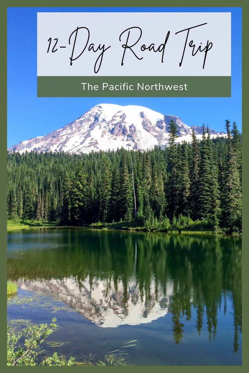
12-Day Pacific Northwest Road Trip

Known for its green landscape, snow-capped mountains, and cozy weather, the Pacific Northwest is one of the most beautiful, idyllic places to road trip in the US.
Although there’s no official boundary to define the Pacific Northwest (PNW), most people consider the states of Washington, Oregon, and Idaho to be included. For the purposes of this road trip, we also include the states of Wyoming and Montana to give you one phenomenal road trip spanning five national parks and some of the most gorgeous views in the States.
Here’s our pick for how to roadtrip the Pacific Northwest in 12 jam-packed, adventurous days!
PNW Road Trip Map

You can customize your Pacific Northwest road trip depending on how much time you have to explore and what you’re most interested in seeing. For example, if you have one week instead of 12 days, consider skipping Craters of the Moon, as well as Grand Teton, Yellowstone, and Glacier National Parks. After visiting Crater Lake National Park, make your way back to Seattle the same way you came or by making a loop through the Wallowa-Whitman National Forest.
You could also add North Cascades and Olympic National Parks to the beginning or end of your road trip, as both parks are 2-2.5 hours from Seattle (in different directions). Or, take the scenic route from Portland to Crater Lake National Park, following the Oregon Coast Highway!
Our 2015 PNW Road Trip
As Road Trip Locals, we love mapping out a road trip route and finding fun destinations to combine together for an epic adventure. There’s nothing quite like a full circle of stops to get us excited about traveling and how we’re optimizing the miles along our route.
This has been one of our favorite ways to explore ever since Jon & I began traveling together way before we started Road Trip Locals. In the summer of 2015, we took a 16-day road trip through the Pacific Northwest in between graduation and starting new jobs. We flew from Baltimore to Seattle, rented a car, and then drove 2700 miles, hiked 119 miles, and explored 5 national parks.
We climbed mountains, jumped off a cliff into the bluest water I’d ever seen, and saw geysers erupt in front of us. Our PNW Road Trip was an incredible adventure that must have planted a seed for many more road trips to come.
If you love hiking, being in nature, and hitting the open road, you’re going to love this Pacific Northwest Road Trip! We condensed our route into 12 jam-packed, incredible days to help you see and experience a ton of highlights along the way.
The best time to road trip the Pacific Northwest
Summer is generally the best time of year to road trip the Pacific Northwest. Just bring layers, as temperatures can vary from week to week and even morning to night.
For example, we visited in the summer during a heat wave. It was HOT during our trip to Seattle and Portland, but we were actually cold once we got to Yellowstone. Temperatures were fine during the day (around 80 degrees) but dipped towards the 30s at night. We barely had enough layers to keep warm while camping, but as two kids adventuring on summer break, we didn’t mind… that much!
Summer months not only give you the most daylight for exploration and driving between stops, but they’re also when the majority of scenic highways, hikes, and other attractions are open. Plus, summer months are great for wildflowers!
Itinerary Overview
Use the table of contents below as an overview of this 12-day Pacific Northwest Road Trip. Then, keep reading for suggestions on what to do and see during each stop.
Table of Contents Hide
Day 1: Drive or Fly to Seattle, WA
We recommend starting your Pacific Northwest Road Trip in Seattle, Washington. Fly into Seattle-Tacoma International Airport and pick up a rental car.
If you’re driving, drive to the closest point on the loop to you, then make a full circle to return home.
Head to Mount Rainier as soon as you arrive or stay in Seattle to explore the city for a few hours. Depending on when you arrive in Seattle, consider checking out one or more of the following Seattle attractions:
The Space Needle
Pike Place Market
The Original Starbucks (the Pike’s Place Starbucks store)
The Seattle Great Wheel

View of Mount Rainier from the Space Needle

Pike Place Market
Day 2: Mount Rainier National Park
Drive from Seattle to Mount Rainier National Park. It’s about a 2.5-hour drive.
Hike the Skyline Trail Loop
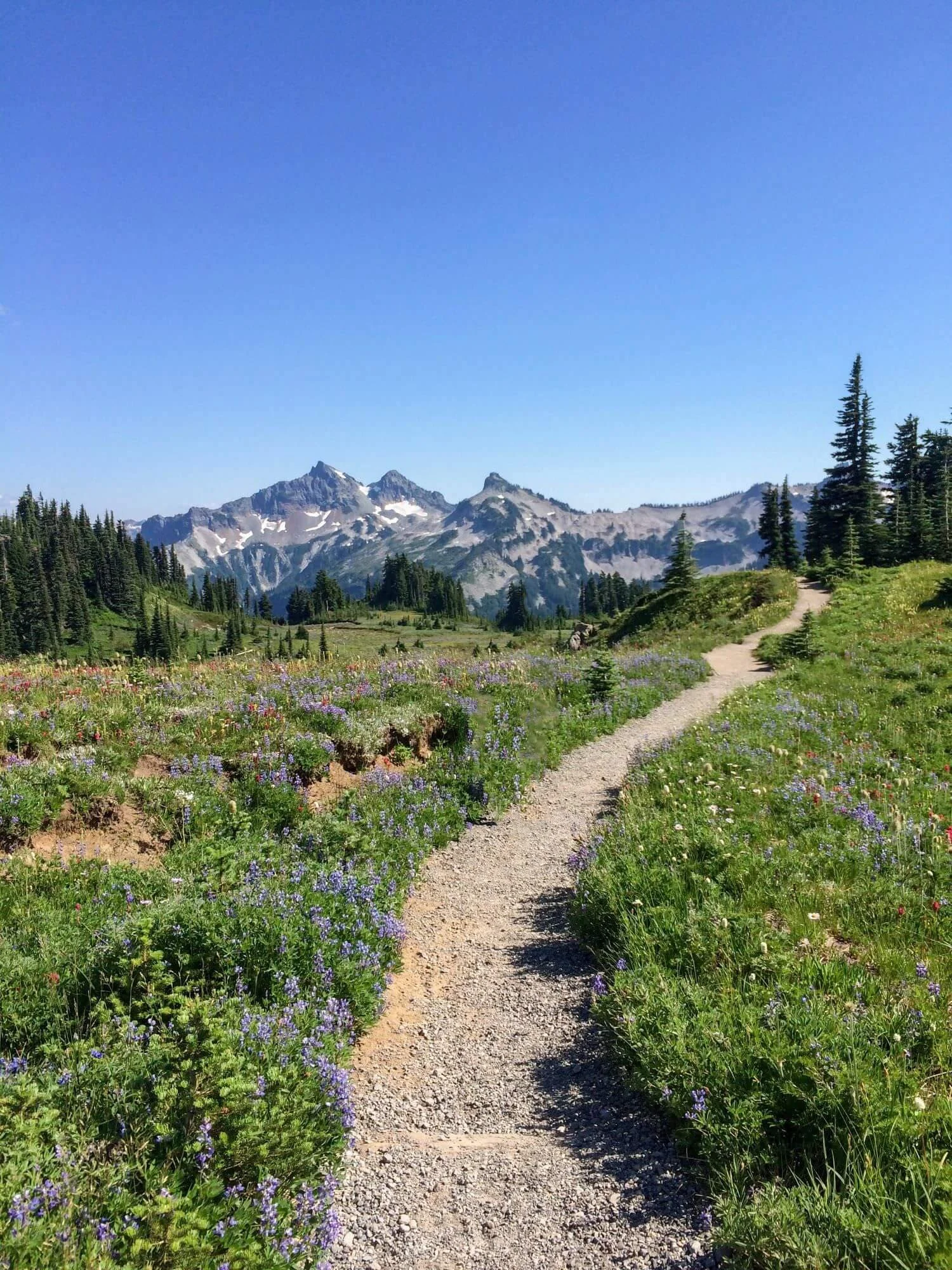
One of the most popular things to do in Mount Rainier National Park is to hike the Skyline Trail Loop. This approximately 6-mile loop takes about 4-5 hours to complete and begins near the Jackson Visitor Center at the Paradise area, which is one of the most visited areas in the park.
The Skyline Trail Loop is gorgeous and offers awesome views of Mount Rainier, alpine meadows, glaciers, diverse flora and fauna, and, in the summer months, beautiful wildflowers!
Difficulty: The Skyline Trail Loop gains around 1,700 feet (518 meters) in elevation, so it is moderately difficult. The trail is well-maintained but does involve some steep sections and uneven terrain.
Season: The trail is typically open from late spring to early fall, depending on snow conditions. The best time to hike the Skyline Trail is during the summer months when the wildflowers are in bloom, and the weather is generally more favorable.
Trail Highlights: Some of the notable highlights along the Skyline Trail Loop include Myrtle Falls, Panorama Point, and the Paradise Glacier overlook. These scenic viewpoints offer excellent photo opportunities and are popular spots to rest and take in your surroundings.
Permits: A valid National Park pass is required to enter Mount Rainier National Park. Additionally, backcountry camping permits are required for overnight stays along the trail, but day hiking on the Skyline Trail Loop does not require a permit.
Dog-Friendly? Dogs are not allowed on trails at Mount Rainier.
The Skyline Loop Trail in Mount Rainier
Hike to the Reflection Lakes
For an iconic view of Mount Rainier, head to Reflection Lakes. This is a popular and relatively easy excursion that offers some of the most stunning views of Mount Rainier mirrored in the calm waters of the lakes. Reflection Lakes are also located in the Paradise area of Mount Rainier National Park and are accessible from the Paradise Visitor Center (the starting point for the hike).
The hike to Reflection Lakes is relatively short, ranging from 0.5 to 1 mile (0.8 to 1.6 kilometers) round trip. The highlight of this hike is the breathtaking view of Mount Rainier reflected in the waters of Reflection Lakes. It’s particularly beautiful during the early morning or late evening when the light is soft and the mountain's reflection is most vivid.
Difficulty: With minimal elevation gain, the hike to Reflection Lakes is relatively easy and suitable for families with children as well as casual hikers. The trail is well-maintained and mostly flat.
Season: The Reflection Lakes area is accessible year-round, but the best time to hike to the lakes is typically from late spring to early fall when the weather is milder and the wildflowers are in bloom. During the winter months, the area can be covered in snow, creating a different but equally beautiful landscape.
Dog-Friendly? Dogs are not allowed on any trails in Mount Rainier National Park.

Reflection Lakes in Mount Rainier National Park
Day 3: Columbia River Gorge
After a full day in Mount Rainier National Park, drive about 3 hours to Columbia River Gorge National Scenic Area. The Columbia River Gorge is a spectacular canyon carved by the Columbia River, which forms part of the border between the states of Oregon and Washington.
Drive the Columbia River Highway
The Columbia River Highway, often referred to as the Historic Columbia River Highway, is a scenic highway located in the Pacific Northwest that runs through the Columbia River Gorge in Oregon.
Drive as much of the Columbia River Highway as you’d like, stopping at various overlooks and points of interest, such as Multnomah Falls, Latourell Falls, and Bridal Veil Falls. Along the way, also enjoy panoramic vistas of the Columbia River, towering basalt cliffs, and lush forests!
Note: To access one of the most scenic portions of this drive, often called the “waterfall corridor,” you may need to purchase a permit. This portion of the highway allows access to many popular hikes and sites, including Multnomah Falls.

View of the Columbia River along the Columbia River Highway
Visit Multnomah Falls
Multnomah Falls is one of the most iconic and picturesque waterfalls in the Pacific Northwest. Viewing these falls is one of the most popular things to do in the Columbia River Gorge Scenic Area!
Note: You may need to purchase a permit to access the road to this viewing area. Multnomah Falls is located in the Columbia River Gorge, east of Troutdale, Oregon, along the Historic Columbia River Highway. It's approximately a 30-minute drive from downtown Portland, which is where we’ll recommend you head next.
Multnomah Falls plunges in two major steps, with the upper falls dropping 542 feet (165 meters) and the lower falls cascading 69 feet (21 meters), making it one of the tallest waterfalls in the United States. It’s surrounded by lush rainforest and is especially beautiful during the spring and early summer when wildflowers bloom.
Accessibility: Multnomah Falls is accessible from the Historic Columbia River Highway and Interstate 84. A pedestrian bridge spans the lower falls, providing visitors with a close-up view of the cascade. A paved trail leads to a viewing platform at the top of the falls, offering panoramic views of the Columbia River Gorge.
Hike to the top: You can hike to the top of the falls via a steep trail that climbs approximately 600 feet (183 meters) in elevation. Additionally, the Columbia River Gorge offers numerous hiking trails, scenic viewpoints, and recreational opportunities such as picnicking and birdwatching.
Dog-friendly? Many trails and scenic areas, including Multnomah Falls, are dog-friendly.

Look at those young kids!
Day 4: Portland, Oregon
After exploring the Columbia River Gorge, drive about 30 minutes to Portland, Oregon, for the next stop along your Pacific Northwest Road Trip.
Take in the city with one or more of the following suggestions:
Visit Powell’s City of Books (the largest independent bookstore in the world)
Grab a wood-fired pizza at Oven and Shaker (about a two-minute walk from Powell’s City of Books)
Explore the Portland Japanese Garden
Enjoy a donut at one of Portland’s many donut shops, such as Voodoo Doughnut, Doe Donuts, Blue Star Donuts, or Pip’s Original Doughnuts & Chai
Or take a day trip to the Oregon Coast!

Powell’s City of Books (largest independent bookstore in the world!)

Portland Japanese Garden
Day 5: Crater Lake National Park
After a night in Portland, drive about 5 hours to Crater Lake National Park. If you want more time exploring the city, you could also spend another day in the city, and then drive about 2 hours to Eugene, Oregon. The next morning, drive about 3 more hours to Crater Lake.
Drive the Crater Lake Scenic Rim Drive
We highly recommend starting your visit to Crater Lake National Park by driving the 33-mile Scenic Rim Drive. Stop at as many of the 30 overlooks as you’d like along the way. The views are absolutely incredible!
The Crater Lake Scenic Rim Drive is a gorgeous route that encircles Crater Lake, the main feature of Crater Lake National Park and the deepest lake in the United States. Highlights along the route include numerous overlooks with panoramic vistas of the deep blue waters of the lake, the sheer cliffs of the caldera rim, and the volcanic formations that shape the park's terrain.
How to get here: The Crater Lake Scenic Rim Drive begins and ends at Rim Village, the main visitor center in Crater Lake National Park. You can access the drive from several points around the rim, including Rim Village, North Junction, and Munson Valley.
Points of Interest: Along the Scenic Rim Drive, you can view attractions such as Wizard Island, a cinder cone volcano that rises from the center of Crater Lake. Additionally, the drive provides access to several hiking trails that lead from viewpoints along the rim to the lakeshore and other picturesque destinations.
Open Dates: The Scenic Rim Drive is typically open for vehicular traffic from late spring to early fall, weather permitting. Portions of the road may be closed during the winter months due to snow accumulation and hazardous conditions.

View of Crater Lake and Wizard Island from the Crater Lake Scenic Rim Drive
Hike Discovery Point Trail or Watchman Peak Trailhead
There are many hiking trails around Crater Lake. Park your car at the Rim Visitor Center and choose whichever trail excites you most!
One of our favorites is the Discovery Point Trail, a 2.4-mile out-and-back trail with plenty of spots to soak in the beauty of Crater Lake. You can extend the Discovery Point Trail to Watchman Peak Lookout via the Rim Trail.

Hiking the Discovery Point Trail around Crater Lake for a closer look
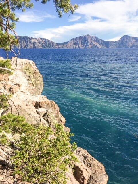
Follow the Cleetwood Cove Trail to the Shoreline
If you want a closer look at the blue water of Crater Lake, or maybe even want to jump in, you can access the shore of Crater Lake using the Cleetwood Cove Trail. (This trail is usually open from mid-June to late October.) Put your feet in Crater Lake, fish from the shore, or plan a boat tour around the lake. Swimming in Crater Lake is absolutely worth the steep hike down to the shoreline!
Difficulty: This hike is about 1.1 miles each way, and since you’ll be walking down to the shores of Crater Lake (and then you’ll walk back up to the rim), this is a moderately strenuous hike. The views at the bottom are worth it, though!
Dog-Friendly? Dogs are not allowed on the Cleetwood Cove Trail.

Putting your feet in Crater Lake is worth the trek!
Jumping into the water off a small cliff was so refreshing!
Day 6: Crater Lake or Drive to Craters of the Moon
Spend another day enjoying Crater Lake, then drive to Redmond, Oregon (about a 2-hour drive), or wake up first thing and drive all the way to Craters of the Moon National Monument & Preserve, which is about a 9.5-hour drive from Crater Lake.
Day 7: Craters of the Moon National Monument, Drive to Grand Teton NP
Looking through pictures on our computers and phones, you wouldn’t know we went to Craters of the Moon… because we apparently didn’t take any pictures. (WHAT?!)
We certainly weren’t anticipating ever becoming travel bloggers back then… we were just two kids on an epic road trip trying to soak up as much of the Pacific Northwest as we could before starting new jobs once we got back home.
So while we don’t have any pictures to share from the Craters of the Moon, we do remember one of the trails we most enjoyed exploring while there!
Explore Lava Caves on the Caves Trail
There are currently over 500 documented caves at the Craters of the Moon National Monument, with the majority of those caves being “lava tubes.”
According to the National Park Service, these caves formed when the cooling exterior of an active lava flow insulated the molten river within, allowing it to continue to flow. Lava could flow for many miles until the source was diverted or cut off, leaving behind a lava cave.
You can explore these caves from the Caves Trail. Make sure to grab a free permit from the visitor center or entrance booth before your hike.
After exploring the Craters of the Moon National Monument, drive about 3 hours and 15 minutes to Grand Teton National Park.
Days 8-9: Grand Teton & Yellowstone National Parks
During our 2015 Pacific Northwest Road Trip, we spent five total nights in Yellowstone to visit Yellowstone & Grand Teton National Parks, but you can lengthen or shorten this part of your road as desired. (We spent one night at Madison Campground, one night at Grant Campground, and three nights at Canyon Campground.)
For simplicity — and to keep this road trip to 12 days or fewer — we’re sharing this road trip with just two days in Yellowstone and Grand Teton National Parks. (One full day exploring each.) But since there is enough to do in each park to keep you busy for MUCH longer, we’ll share additional ideas for hikes and activities if you have more time!
Full Disclosure: We know one day in each park is not nearly enough time to see everything there is to see in Grand Teton and Yellowstone National Parks. But if you’re interested in adding these stops to your itinerary, one day in each park can give you a taste of what the parks offer. Then, once you’re home from your PNW Road Trip, we highly recommend planning a standalone road trip to Yellowstone, Grand Teton, and Glacier National Parks next :)
You can split up your stays, staying in both Yellowstone and Grand Teton National Park, or you can pick one park to stay in and make day trips to the other. (If you do this, we recommend staying near Colter Bay Village in Grand Teton National Park and the Old Faithful area in Yellowstone National Park.) For our PNW Road Trip, we chose to stay in Yellowstone for this entire part of our trip and take a day trip into the Tetons.
Grand Teton National Park
Grand Teton National Park is located in northwestern Wyoming and is known for the iconic Teton Range and many pristine lakes. Just south of Yellowstone, Grand Teton National Park is well worth the stop on your Pacific Northwest Road Trip.
If you have just one day in the park (and aren’t yet tired of being in the car), we highly recommend driving the Grand Teton Scenic Drive. It’s the absolute best way to see the park in just one day.
Or, if you’re more than ready to stretch your legs, here are some of the hikes we recommend in Grand Teton National Park:
Hidden Falls Hike (short but requires a quick boat ride across Jenny Lake)
Phelps Lake Trail (moderate in length but relatively easy)
Cascade Canyon Trail (longest and most difficult of this list)

Hidden Falls in 2015

Phelps Lake in 2023
Yellowstone National Park
We love Yellowstone National Park! It’s probably our favorite national park in the United States. It’s definitely Jon’s favorite, as he loves the abundant wildlife viewing that Yellowstone provides.
In fact, we love Yellowstone so much that we visited once a season in 2023 and created a travel guide to help others fall in love with it too. Our All-Seasons Yellowstone Travel Guide is packed with our favorite wildlife spots, seasonal highlights, time-saving routes, and best recommendations from years of exploring the park. If you're visiting Yellowstone, this is the guide we wish we had when we first started!
Some of our favorite things to do in Yellowstone National Park include:
Driving the Grand Loop (Upper & Lower Loop)
Wildlife watching in Lamar and Hayden Valleys
Seeing Artist Point and hiking to the Brink of the Lower Falls
Hiking the Fairy Falls Trail for a bird’s eye view of the Grand Prismatic Spring, then walking the boardwalks at the Grand Prismatic Spring for a closer look
Watching the Old Faithful Geyser erupt (& many others as well!!) [Note: Old Faithful erupts every ~90 minutes, and the nearby Old Faithful Geyser Basin is great to explore if you arrive early or stay longer.]
Walking the boardwalks at the West Thumb Geyser Basin, which features hot springs, geysers, and vibrant pools along the shore of Yellowstone Lake
Walking the Mammoth Hot Springs Lower and Upper Terraces

Grand Prismatic Spring

Mammoth Hot Springs
Days 10-11: Glacier National Park
Drive from Yellowstone National Park to Glacier National Park, which is about 6 hours from the north entrance to Yellowstone. Here, you can stay on either the east or west side of the park. For our road trip, we camped at St. Mary’s Campground on the east.
Drive the Going-to-the-Sun Road
This is one of the best things to do in Glacier National Park!
Covering 50 miles and taking about two hours to drive, the Going-to-the-Sun Road connects East Glacier near St. Mary’s Village to West Glacier. Enjoy the views, and stop at as many overlooks as you’d like. The highest point along the Going-to-the-Sun Road is Logan Pass, which is the starting point for many of the most incredible hikes in Glacier National Park.
Vehicle registration may be required to drive the Going-to-the-Sun Road from May to September. (At the time of writing, it’s not required when entering via the east, but is required from the west.)
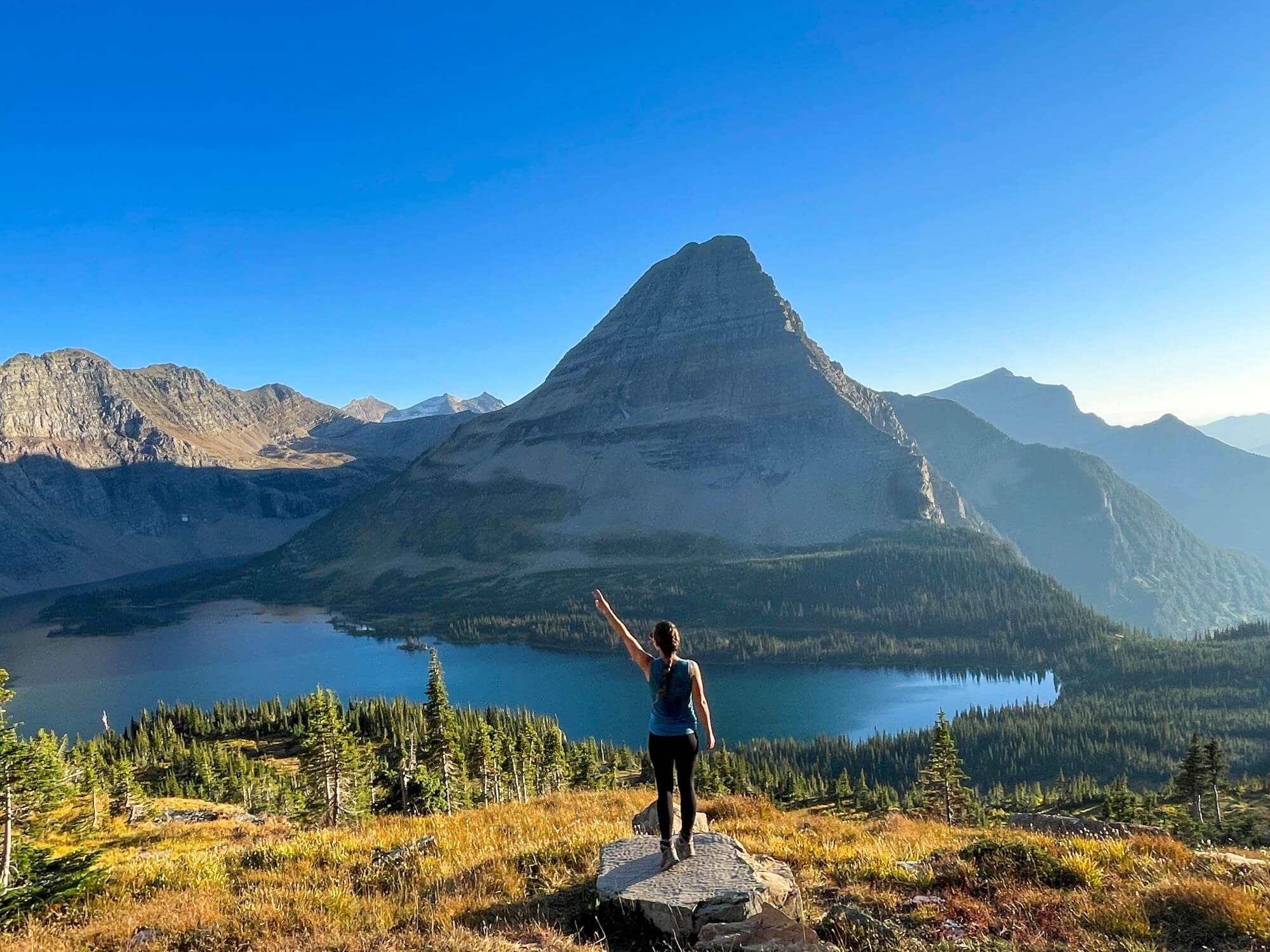
Hike the Hidden Lake Trail
The Hidden Lake Trail is one of the most popular hikes in Glacier National Park. It’s a 5.3-mile out-and-back trail that takes about 3 hours. The views are absolutely incredible on a clear day!
Unfortunately for us, in 2015, we were hiking in so much fog that Hidden Lake fully lived up to its name and stayed 100% hidden. But we were able to make it back as part of our 2023 Travel Season and see the lake in all its glory. Worth. the. wait!
Getting There: Hidden Lake is accessible via the Hidden Lake Trail, which begins at the Logan Pass Visitor Center. This area is the starting point for many popular hikes in Glacier National Park, so arrive early or later in the day to ensure a parking spot.
Wildlife: The Hidden Lake area is known for its abundant wildlife, including mountain goats, bighorn sheep, marmots, and various bird species. During our hike in 2023, we encountered many mountain goats, some of whom were walking on the trail itself!
Visitor Center: The Logan Pass Visitor Center serves as the starting point for the hike to Hidden Lake and offers exhibits, information, and restroom facilities for visitors. The center is typically open during the summer months when the Going-to-the-Sun Road is fully accessible.
Seasonality: Hidden Lake is accessible during the summer and early fall months when the Going-to-the-Sun Road is open and free from snow. The best time to visit is typically from July to September when wildflowers are in bloom and wildlife activity is at its peak.

Hidden Lake completely hidden by fog in 2015
A stunningly clear day in 2023!
Hike to Avalanche Lake
Another amazing hike in Glacier National Park is Avalanche Lake. We had better luck with the scenery on this one and have been rewarded with gorgeous views both times we’ve hiked this trail.
Avalanche Lake Trail is an approximately 6-mile out-and-back hike that follows a relatively easy trail through the forest before opening up to Avalanche Lake. This was Jon’s favorite view/hike in all of Glacier National Park!
Getting There: Avalanche Lake is in the western portion of Glacier National Park, near the Going-to-the-Sun Road and Lake McDonald. There is limited parking at the trailhead, Trail of the Cedars parking area, so this is a great hike for early morning or later in the day.
Trail: The trail to Avalanche Lake meanders through old-growth cedar and hemlock forests, following the path of Avalanche Creek. Along the way, you’re treated to glimpses of waterfalls, wildflowers, and scenic viewpoints. The trail gradually ascends, with relatively little elevation gain, making it suitable for families and casual hikers.
Seasonality: Avalanche Lake is typically accessible from late spring to early fall, depending on snow conditions. The best time to visit is during the summer months when the trail is free from snow, and the weather is mild. However, the area can be busy during peak season, so you may want to arrive early in the day (or in the afternoon) to avoid crowds.

Avalanche Lake in Glacier National Park
Day 12: Return to Seattle
It’s about a 9-hour drive from West Glacier to Seattle. There, you can drop off your rental car and fly home, reflecting on all of the incredible places you’ve explored over the last two weeks!!
Customize Your Trip
There are many ways to customize your Pacific Northwest road trip.
One option is to skip Craters of the Moon, Grand Teton, Yellowstone, and Glacier National Park. After Crater Lake, make your way back to Seattle the same way you came or by making a loop through the Wallowa Whitman National Forest.
You could also add North Cascades and Olympic National Parks to the beginning or end of your road trip. Both parks are 2-2.5 hours from Seattle. Since they’re in different directions, it might be fun to add one to the beginning of your trip and one to the end!

Save this itinerary for a future road trip!
Hover over either image below and click on the red “Save” button that pops up in the upper lefthand corner of the image to save this on Pinterest for later. (If you’re on mobile, you might have to tap the image first to see the red ‘Save’ button.)

Related Posts


